Follow me on Instagram. Writing over there means I can cut and paste to produce a post here. No writing twice. My eyes are still bothered by big displays and i must limit my screen time.
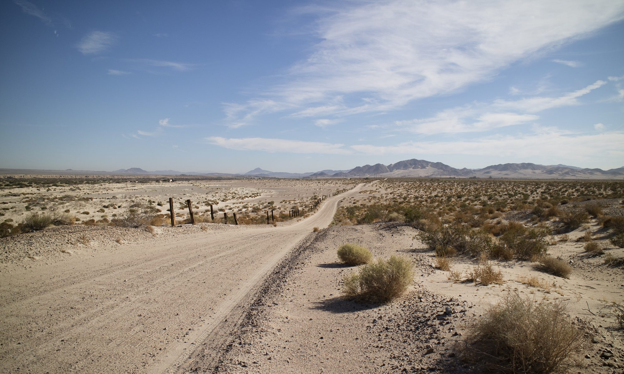
In three days I was run off land I was taking pictures on. A new record. Once by a public official and one by a private security guard. (Who had a K9 with him.) Some thoughts.
Anyone patrolling and protecting private or public land gets hard from dealing with thieves, vandals, squatters, pot growers, and people off-roading where they shouldn’t.
As such, you are most likely deemed a profiteer no matter what you are doing. If I have a camera, the question is always, “Are you a professional? Are you selling these photographs?” If I am rockhounding, it’s always, “Do you make money off of this?” Sigh.
My attempts at explaining are always seen as arguing. It puts these people immediately on the defensive. You don’t not want to do that. I say what I am doing, I am always friendly, and I always leave an area as asked. It doesn’t matter if I am right or not, I do not want to fail what cops call the attitude test.
Law enforcement can throw you into jail for almost anything. Whether the charges stick, that’s another matter. Right now, you are in jail. A police officer puts you in jail under what are called booking charges. They can be practically anything. It’s the district attorney (or whatever other official is tasked with prosecutions), who decide what the final charges will be. If any.
In questions like trespass, the DA probably doesn’t want to even consider the case. You may be fined with no further jail. The DA may be more mad at the police officer for bringing them another case that isn’t a priority. To that point, a policeman also doesn’t want to develop a history of jailing people on minor charges who get immediately released.
I belong to the Public Lands for the People and have a bumper sticker for them on my truck. They advocate getting all sorts of information from the officer in case you are stopped. I don’t ask for an officer’s full name. If I need to, I’ll get their license plate number. That will be enough to identify them later on. Less confrontation.
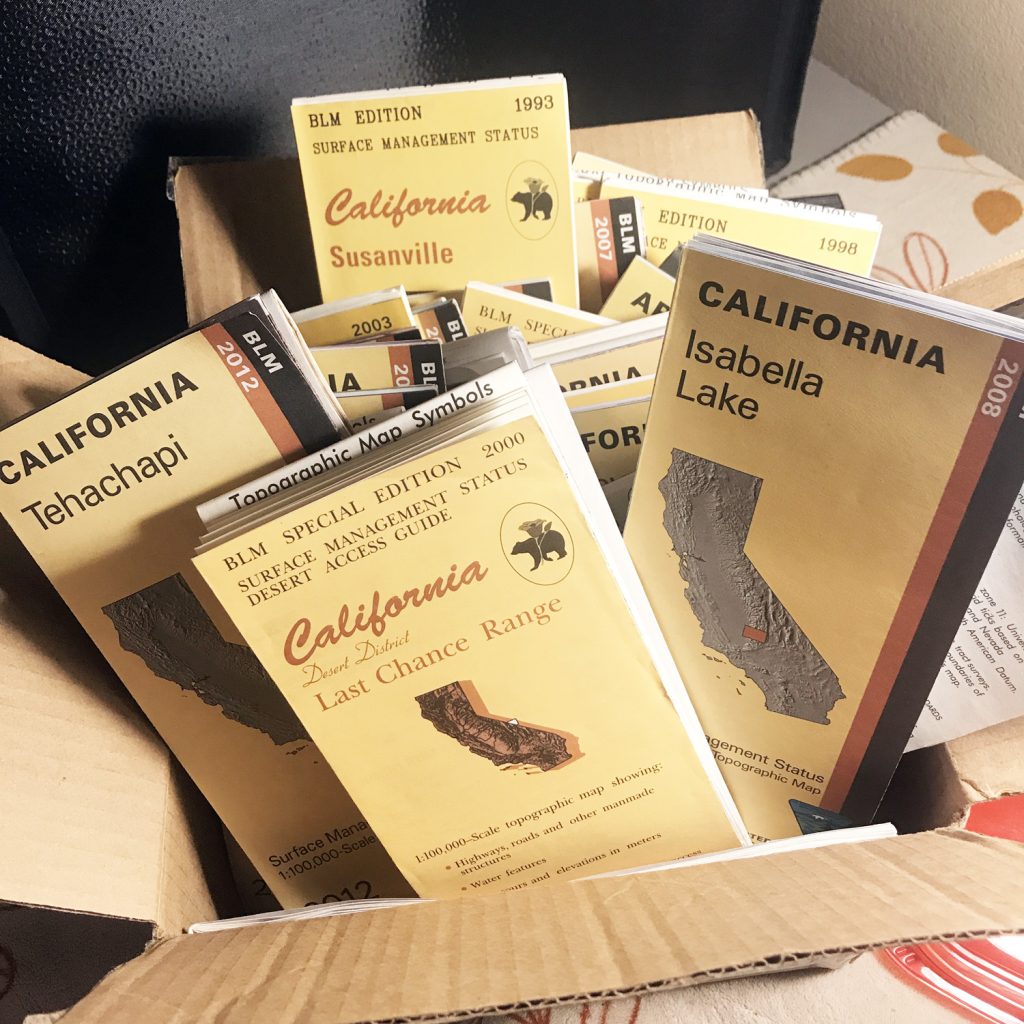
Speaking of names, if you mention someone in their agency, be prepared to have that name. “I know someone.” “Okay, Jack, who?” A printout is best, don’t be stuck by the side of the road searching through your e-mails on your phone. I carry printouts of current rockhounding regulations for both the BLM and USFS in my truck, along with the rules for collecting in Wilderness Areas. I have printed out my correspondence with certain state and national level BLM and USFS officials, along with their phone numbers.
Anything on paper is far better than describing it. If you want to try to explain yourself. Which, again, may seem argumentative and confrontational. Your call. Good luck.
Oh, if you are doing something really debateable, get the business card of a criminal defense lawyer and keep it in your wallet. Pay for an hour of their time to introduce yourself and tell them what you are doing. Find someone who practices criminal law, nothing else. They are very different from other lawyers. And get the business card of whatever bail bondsman that attorney recommends. Just saying.
— https://www.instagram.com/tgfarley/ Follow me on Instagram: tgfarley
Claim markers or monuments must be maintained for the life of the claim. There is no way to establish that a claim was ever staked to begin with without them. Protecting a claim from high graders by removing monuments fosters the trade in illegally recorded claims. BLM requires any new claimant to seek out existing claim markers before locating a new claim. Without those marks on the ground a miner cannot fulfill BLM’s requirements.
Real Field Experience
Mining claim research is essential but mired in questions that do not quit, with laws rarely followed in practice. Claim owners know they need to pay annual assessment fees to BLM, but those fees often cover oddly claimed ground which may lack monuments and have no record at the county assessor office.
I use MyLandMatters.org for research. They pull their information directly from BLM and present it in a friendly, graphical manner. They have a zoomable map that is extremely easy to use, whereas, BLM is still single line entry, or command line interface. You type your PLSS information one digit at a time and, in fact, you have to pad your entries with zeros. I will stop before I start ranting about LR2000, a nightmare to use since it was first put on the net. In many ways it was easier to pull records at a State BLM HQ than it is now to use LR2000.
In any case, when you drill down to an individual claim report and click on the link at MyLandMatters, you are directly accessing any current BLM report. You will only get data, though, and not the map that the miner drew of the claim. Instead, you will find a legal land description with no GPS coordinates. Mining claims are not recorded at BLM using lat/lon. The miner’s original folder may include coordinates along with supplemental information but none of this is scanned by BLM or put online. Just the PLSS stuff. By the way, I financially support MyLandMatters and I hope you can, too.
http://mylandmatters.org/
For context, I was recently in the Goodsprings Mining District in Clark County, Nevada. Before going I noticed a very strange thing in the section I was interested in: 17 current lode claims of 20 acres each in an area of desert alluvium. What?
T.24S, R.58E, Section 8. Mount Diablo Meridian.
In checking BLM records, I saw that each of these claims were indeed filed under lode and not placer. In an area of unconsolidated rock. — —
When I got to the section I noticed an almost complete lack of claim markers. In theory there should be 68 but, of course, all monuments at some point get vandalized or are not maintained. I know, I am a former claim owner. But I only found two monuments in the square mile area I walked around. Two markers?
Without any markers it was impossible to peacefully collect or prospect, never knowing if I was on claimed ground. It shouldn’t be up to me to guess. The problem is on the claim owner. Some may disagree, saying that it is up to the wandering prospector to know where they are. Without monuments being maintained, however, the whole system falls apart. Your only other choice is to pull every claim folder in the section at the county assessor’s office, provided they all exist, copy the maps in those folders, and then bring all that paper back into the field. At that point you will have to reconcile these maps, hoping they were accurately done. Which most aren’t, most being hand drawn and all allowed a margin of error when filed. And you must relate them all without monuments or markers. Good luck.
What is the point of setting markers or monuments unless they are maintained? Otherwise, you just have open ground without any landmarks at all. There is no point in building something if you do not maintain it. Here’s is what BLM states, taken from the .pdf linked above:
“Staking a Mining Claim or Site Federal law simply specifies that claim and site boundaries must be distinctly and clearly marked to be readily identifiable on the ground (43 CFR Part 3832). The General Mining Law allows States to establish their own laws regarding the manner in which mining claims and sites are located and recorded. Location requirements include the placement, size, and acceptable materials for a corner post or a discovery monument. Check with the proper State agency before locating mining claims. State agencies may include the State’s geological survey, mineral resource department, lands commission, or department of environmental protection. Generally, staking a mining claim requires: • Erecting corner posts or monuments • Posting a notice of location on a post or monument in a conspicuous place (see Figures 1 and 2) • Complying with the requirements of 43 CFR Part 3830, 3832, and 3833.” (Emphasis added, ed.)
One must maintain these markers since there is no other way to tell if they were ever put up in the first place. They must be clear and distinct, not invisible. To make clear, without markers on the ground, there is no way to tell if they were ever there. Someone could have filed a claim online from a thousand miles away and then maintain that someone took down their markers. After they’ve sold that claim on eBay. It happens. Often.
The Nevada Mining Association represents commercial mining in Nevada. They know what they are talking about. In regard to staking claims, they make monument importance quite clear in a teaching guide focused on fundamentals, “The markings on the ground that outline a mining claim’s boundaries establish the claim’s location. These markings take control over descriptions given in location notices or deeds. As much, it is very important that the markings adequately define the limits of the claim.”
Again, it’s not the paper map in that file folder that controls, it is the marks on the ground. They are the only real, hard, physical proof that the claim exists.
“Federal law specifies that claim boundaries must be distinctly and clearly marked to be readily identifiable. Most states have statutes and regulations concerning the actual staking and recording of mining claims so claimants should refer to the appropriate state agency for additional requirements before locating a claim.
Prior to locating a claim, a prospector should check BLM records for prior recorded claims. Ultimately, the prospector must check for prior existing claim markings on the ground.”
Check for prior claim markings on the ground. Exactly. You can’t post and then neglect them. They must be there for the life of the claim. We as miners must make an effort to keep them up. What if BLM wanted to check on your claim? How would they find it without markers? Or any other government agency? Fraud has run through mining from the beginning. People sell claims on eBay, only to have the new owner wind up at a local rock shop to get help finding it.
BLM says that anyone thinking of locating a new claim must check for prior claim markings on the ground. Not maintaining them makes this BLM requirement impossible for another miner to fulfill. We as fellow miners can’t participate in this. I some know people want the system to work overall, but not have it apply to them. They fear people will raid their claims.
It’s often said the biggest problem with having a claim is keeping people off of it. I think, though, that people would seek good ground if a claim is well marked or not. Anyone who has identified a claim through BLM and is willing to travel to a distant area will not be deterred by a lack of markers. You may slow them down but you won’t stop them. High graders will always be around.
I have been citing the law and BLM statements and I wish anyone disputing what I am writing would cite the law as well. It gets very distressing to argue with people who cite nothing. We may disagree on a law, but a cite a law! Throw me bone. I edit and revise content for law firms across the United States and Canada. Specifics are everything. What law? What rule? What reg? If it is a court case, which one? Give me a cite. Otherwise, you have nothing but an opinion based on nothing. A judge won’t listen to that and neither should you.
No system can be built on file and forget. This attitude is completely disrespectful to our fellow miners and the rockhounding community. We inform, we communicate, we make clear. We don’t hide our claims. I maintained my markers since I was and am a good miner. I fully expect the same from everyone else.
This impacts the entire mining and rockhounding community. If I am traveling to Virginia City, for example, I will pass through five different counties as I drive along I-95. I might make ten to twelve stops along the way to check different outcroppings and desert washes. I have my BLM surface status maps and I can usually expect to connect to MyLandMatters to see how heavily claimed ground is if I have cell phone service. But that is as far as I can go. No online resource shows claim boundaries that aren’t patented.
It is totally impossible to expect any rockhound or prospector to find each county assessor’s office for copies of claim maps on such a three hundred mile run, especially on a weekend when those places are closed. Collect maps and then go back? Every time? To pick up a quarter bucket of sand or an interesting piece of andesite? Some offices are dozens of miles from a collecting spot. That’s an entirely impossible and unrealistic mission. Back to Goodsprings.
BLM says some states only require a monument at the place of discovery, not all four corners. Nevada, though, does require four corner staking.
In doing my research, claim names like Cindy seemed innocuous and the stuff of small scale mining. But there were a lot of Cindys. One was named Cindy #288. Opening up my browser window further, I saw that Cindy was owned by ASARCO which is a world wide mining company. Every commercial operator on the planet knows ASARCO . (They offer a fine tour of their open pit Mission Mine property south of Tucson, by the way, and I highly recommend it.) The other claims were held by COVADA LLC, a corporation registered on Ellis Street in San Francisco.
Both corporations are, in effect, absentee landlords. While ASARCO and other “majors” have the money to keep claims going, they don’t want to spend money to put people in the field to keep up their markers. What kind of penalty would they face, anyway? Are you really going to sue ASARCO in federal court over a missing marker? Is BLM going to penalize them? Both situations are laughable. So, nothing gets done. Only the seven Jet Silver claims appeared to be owned by locals since their mailing address is in Jean, Nevada, just ten miles from Goodsprings. Click on the image below to enlarge. — —
Another interesting thing about the BLM reports was that only the COVADA claims had a county book and page number. The paperwork for a valid non-patented mining claim must be filed with BLM and with the county assessor’s office for the county in which the claim exists. Both places. Otherwise, the claim isn’t valid. This information may not appear on a BLM claim report but you’d have to check with the county in question to be positive that the claim wasn’t registered. Information goes missing with records, it happens. It means, though, more research and time wasting. Do you really want to do this? Far more simple to get on the ground.
In the field, though, you could come across someone who filed with BLM and not the county. Some miners don’t like to pay county filing fees or be noticed. In this case, you might be right that they don’t have a valid claim. You could also be dead right. Depending on the circumstances, it is usually best to move down the road if a dispute comes up. Always have your research printed out before prospecting on well claimed ground and always be prepared to move on. At least for that moment. —
—
Further fun ensues when you realize BLM allows a margin or error when recording the corners of a claim. Most miners don’t have their claims professionally surveyed. And there is no way to determine where a missing marker should be anyway, since none of this is based on GPS coordinates. This is all legal land description stuff, again, the public land survey system of meridian, township, range, and sections. And quarter sections and so on. A lode claim cutting diagonally through two sections, for example, is mind bending to put down on paper using the PLSS and nearly impossible to recreate on the ground if you are not the claim owner.
The only way you can see what the miner has mapped out is by pulling their claim folder at the State BLM headquarters or at the local county assessor’s office. Claim boundaries for non-patented claims are not available through BLM. Or anywhere else that I know of unless the claim owner has put them online themselves. You may see boundaries on GoogleEarth but these are for patented claims. All you will see online is the number of claims in an area, not their location.
I once saw a miner at BLM headquarters in Sacramento trying to figure out where open ground was on the Trinity, always a good producer. He had photocopied at least ten claim maps and was trying reconcile one with the other, seeking some place to claim. Tricky. Still, he was trying in the only way possible, by pulling folders.
I’ve written enough here, it will make me only mad to continue. Below is some miscellaneous info from various sources that may make sense now that you have read this far.
NOTE: Links were current at time of writing. Use the Wayback Machine at the Internet Archive to recover lost pages: https://archive.org/web/
—
Disclaimer from MyLandMatters
The mining claims represented on these maps are only displayed to the nearest section and DO NOT display the actual claim location. Sections are about one square mile and actual mining claim locations can vary considerably from their mapped location.
The only way to determine an actual claim location is to obtain the County Recorder Location Notice and amendments for the claim in question, study the mapped location and then find the location marker on the ground. Members of the public and other prospectors do not have the right to determine whether an existing claim location is valid, only a court of record can make that determination. Emphasis added
http://www.mylandmatters.org/Maps/Mining.html
RECORDING A MINING CLAIM OR SITE (BLM)
As established by Section 314 of the Federal Land Policy and Management Act (FLPMA), as amended, claims and sites must be recorded with the proper BLM state office within 90 days of the date of location and recorded with the proper county in accordance with their requirements. In Alaska, claims and sites can also be recorded with the BLM district office located in Fairbanks.
County: State laws require filing the original location notice or certificate in the county recorder’s office, county clerk’s office, or borough office. The proper county or borough is the one in which the claim or site is located. Each state has its own requirement for when a location notice must be filed and recorded. The maximum period is 90 days from the staking of a claim or site on the ground. However, some states require earlier filings, such as 30 or 60 days from the date of location. Location notices must contain the following basic information (43 CFR 3832, Subpart A, and 43 CFR 3833, Subpart A):
The date of location on the ground; The names and individual mailing addresses of the locator(s); The name of the claim or site; The type of claim or site (lode or placer claim or mill site or tunnel site;) The acreage claimed; and A description of the parcel on the ground Local printing companies, office supply stores, stationery stores, appropriate state agencies, and BLM offices are some sources where state location notices and certificate forms might be obtained.
Nevada State law (NRS 517.050) requires that locators must record their claims by filing duplicate copies of a certificate of location (Exhibit 3) with the County Recorder within 90 days after posting the notice of location. (The certificate of location is a separate document from the notice of location which must be posted on the monument when the claim is located). The certificate of location must state the name of the claim, the name and mailing address of the locator or locators, the date of location, the number of feet claimed along the length of the vein in each direction from the location monument, the number of feet claimed on each side from the center of the vein, the general direction of the vein, a statement that the work of location consisted of making a map as provided in Nevada Revised Statutes (NRS517.040), and the location and description of each corner and its markings. A claim is void if a certificate of location containing the above information is not filed within the 90-day period. The required map must be filed with the County Recorder simultaneously with the location certificate. — https://www.instagram.com/tgfarley/ Follow me on Instagram: tgfarley
I’ll take a stab at why certain hardcopy maps are still essential, providing a big picture view that a small screen cannot begin to give. For prospecting and traveling to new areas, maps like BLM’s Surface Status Management Maps (Status maps), still lead the way to new ground and new adventures.
Click on the link below if a video preview does not appear above:
I’m reading about two and a half feet at this gage. Not much, but flowing water, never-the-less. Lacking a web cam, that page may be our best guide to what is happening right now.
Updated February 1st, 2020
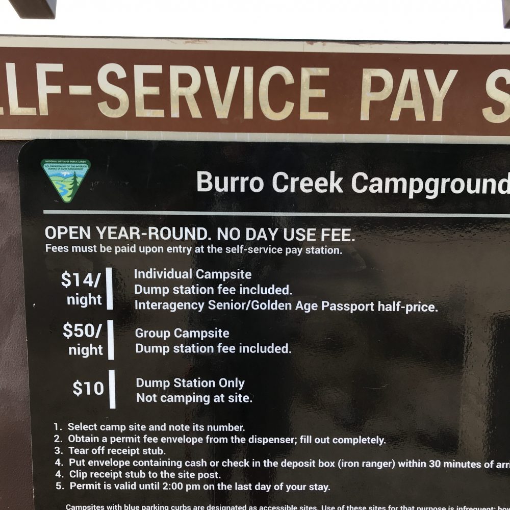
Burro Creek Campground is about ten miles or fewer from Wikieup, Arizona. This campground is base camp for rock clubs from as far as Utah. Agate is the main draw in the surrounding area, not at the camp itself. Potable water, first-come, first serve, the small group camp by reservation. $14 a night for the individual camp sites. Good pull throughs. Would advise smaller vehicles, ideal tent camping. No day use fee!
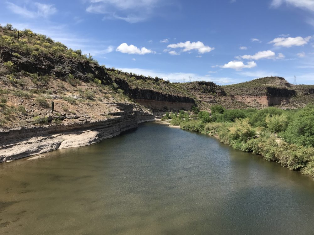
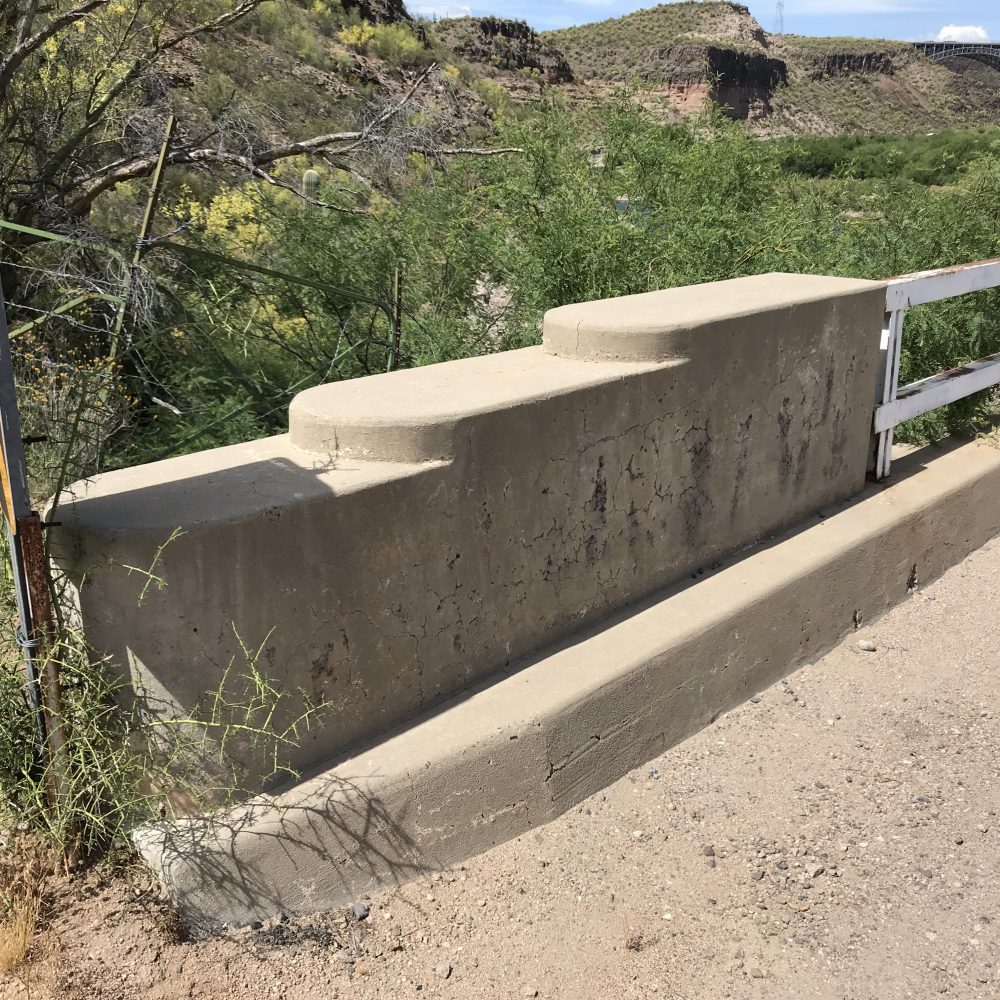
The creek is pretty but pedestrian access is through narrowly spaced pipes and a nasty barbed wire fence encloses the entire campground. Watch your kids around it. Good, clean water flowing right now. Great canyon setting, about 1,900 feet. Didn’t check cell coverage, I assume none. Anybody not enjoying rockhounding would still enjoy this campground. — — View from the bridge over Agate Creek. The canyon invites exploring although get a BLM surface status management map of the area to show public land ownership. — — The bridge abutments are nicely done in Southwestern Art Deco style. — — Don’t drive across the bridge with any large vehicle or a trailer in tow. Single lane dirt road beyond the bridge, I don’t know at what point you could turn around. Ask first. Logical place to turn around is the campground with its pull throughs in the Day Camp and regular campsite areas. Group camp looks tricky to turn around a large vehicle. — The following is from my SW travel list which is free
Burro Creek Recreation Site (BLM managed)
Burro Creek Campground Burro Creek Campground Road
34°32.163′ N 113°27.112′ W Coordinates for BLM campground
These are the coordinates for the preferred intersection of Burro Creek Campground Road and Highway 93:
34°32.02667′ N 113°25.935 W
BLM’s Burro Creek Recreation Site, known to rockhounds as Burro Creek, is frequented mostly for agates. It is approximately 60 miles northwest of Wickenburg. Wikeiup is Burro Creek’s nearest town, with gasoline and limited supplies available. Rock and Gem Clubs from as far as Utah make field trips to Burro Creek, sometimes each year. It is a beautiful area.
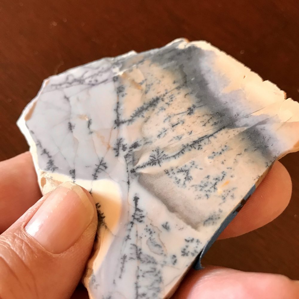
For your first visit, go with a group to find the best spots. People camp at BLM’s Burro Creek Campground since there are no local hotels. Fee charged. Most collecting is done on the other side of Highway 93. Consult Gem Trails of Arizona if nothing else. The most sought agates are those with purple or violet. The slab pictured here was gifted to me, it has a nice violet tinge when seen in the right light. — — The Kingman Field Office manages the area as well as the nearby Upper Burro Creek Wilderness Area. Inquire about the group campground of somewhat small size. A nasty barbed wire fence encloses the campground, a few fence breaks allow creek access. — https://www.blm.gov/visit/search-details/591/2
How about a Google Map to the right intersection?
—
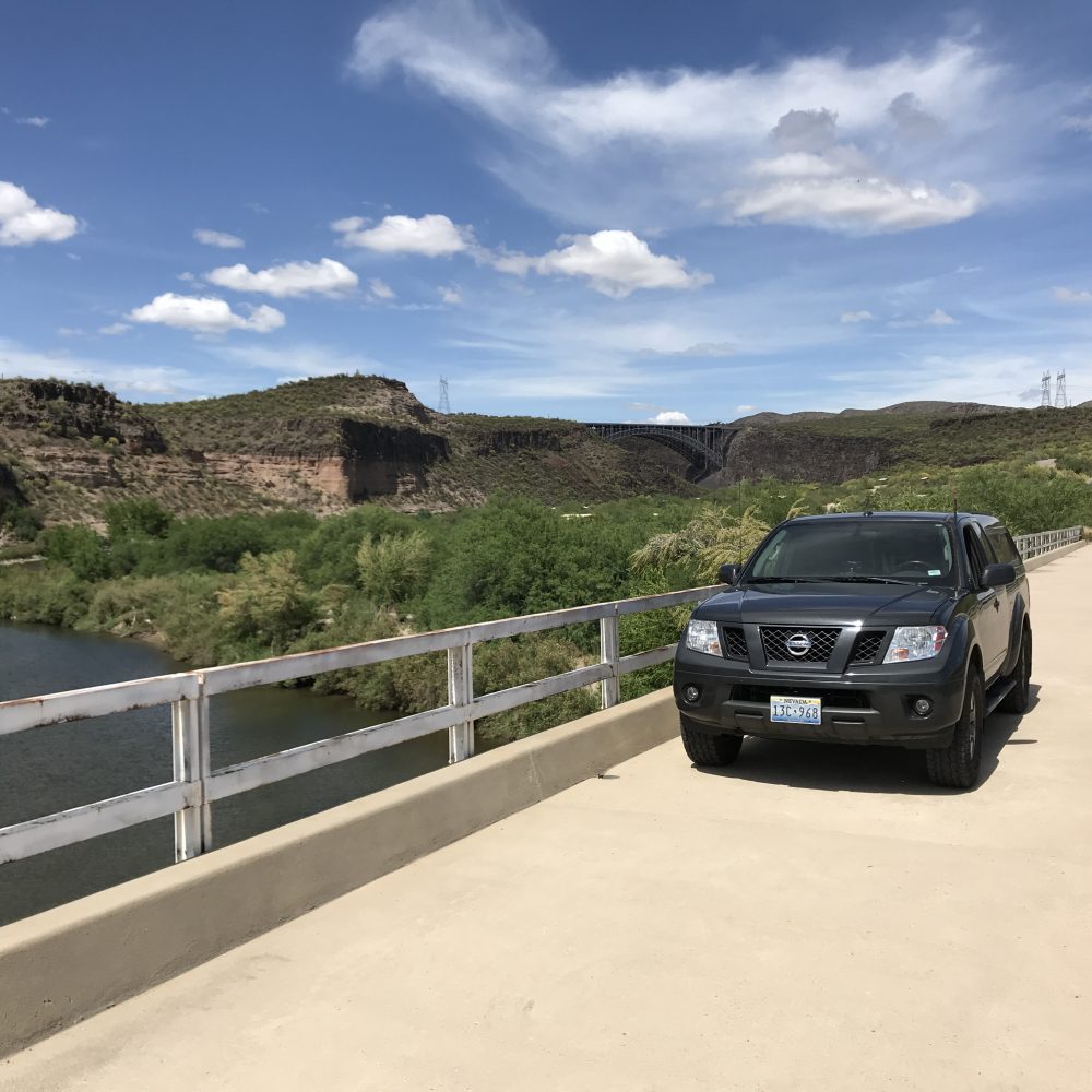
All 4X4 owners want a picture of their rig. It’s a thing. — Follow me on Instagram: tgfarley