A Prospect Too Far

Almost got to the Barnett Prospect but the terrain, time, and not enough water defeated me. I could see the area from the furthest point I reached, only .14 miles away. Yet another five hundred feet of gain. Too much.

I am now taking prescription medicine for my leg and I now have a referral for physical therapy. Perhaps with work I can hike like I used to. Or something similar. Those 4,000 foot gain hikes, though, are probably done. Goodbye Mount Diablo and Pyramid Peak! They were always too much work, anyway.:-)

View this post on Instagram

The leading report says this, Barnett Prospect The Barnett prospect is located on top of a precipitous ridge in the northern part of the study area approximately 2.5 mi south of the Nancy Ann mine (fig. 2). The prospect is accessible by a foot trail from Chicago Valley. A trench was dug in a 2-ft-thick gossan zone of dark-red to brown limonite, geothite, and remnant galena in massive Ely Springs Dolomite. A grab sample collected from a 1-ton-stockpile of galena-bearing gossan material contained 31 percent lead and 19.75 oz/ton silver. However, chip samples collected across the gossan zone contained only 0.05 to 2.6 percent lead and 0.02 to 0.22 oz/ton silver. Two pits and a 29-ft crosscut adit were found in a dark-red clay bed sandwiched between massive dolomite beds. The clay bed is as much as 6 in. thick and was traced for 80 ft along strike. Samples of the clay contained 0.15 to 7.8 percent lead and 0.02 to 0.44 oz/ton silver. Because high concentrations of silver and lead in a clay bed are unusual, it deserves further study. The bed displays no shearing or discordance to indicate that it is a fault gouge, and does not show any evidence of hydrothermal alteration. The identified silver and lead occurrences are too small to constitute a resource.#geology #geologyrocks #mining #inyocounty#nopah#rocks#silver#lead#exploring#getoutside#mojave#mojavedesert #explore#mines#rockhounding#geologistonboard
A post shared by Tom Farley (@tgfarley) on


View this post on Instagram

Easy part is done. #geology #geologyrocks #mining #inyocounty#nopah#rocks#silver#lead#exploring#getoutside#mojave#mojavedesert #explore#mines#rockhounding#geologistonboard

A post shared by Tom Farley (@tgfarley) on


View this post on Instagram

A trail appears shortly. Beautiful country in the morning. I always plan to get back to my vehicle by noon if the temp is going to hit 100 for the day. #geology #geologyrocks #mining #inyocounty#nopah#rocks#silver#lead#exploring#getoutside#mojave#mojavedesert #explore#mines#rockhounding#geologistonboard

A post shared by Tom Farley (@tgfarley) on


View this post on Instagram

Trudge, trudge, trudge. #geology #geologyrocks #mining #inyocounty#nopah#rocks#silver#lead#exploring#getoutside#mojave#mojavedesert #explore#mines#rockhounding#geologistonboard

A post shared by Tom Farley (@tgfarley) on


View this post on Instagram

This would have been a helicopter 🚁 mine. Still, like we say with gold, find it first and figure the rest out later. #geology #geologyrocks #mining #inyocounty#nopah#rocks#silver#lead#exploring#getoutside#mojave#mojavedesert #explore#mines#rockhounding#geologistonboard

A post shared by Tom Farley (@tgfarley) on


View this post on Instagram

Low on water, short on time. Made a shaky phone call with my SatFi-2 and sent text and email to a friend with my SpotX. The canyon walls made fixing on the satellites lengthy but I got my location sent out. The SpotX has any easy way to send out coordinates, the recipient gets the location and then can click on the link to call up Google Maps. Left a little litter here and their in case an SAR team had to go in. #geology #geologyrocks #mining #inyocounty#nopah#rocks#silver#lead#exploring#getoutside#mojave#mojavedesert #explore#mines#rockhounding#geologistonboard

A post shared by Tom Farley (@tgfarley) on

Getting Closer to the Barnett Prospect

View this post on Instagram

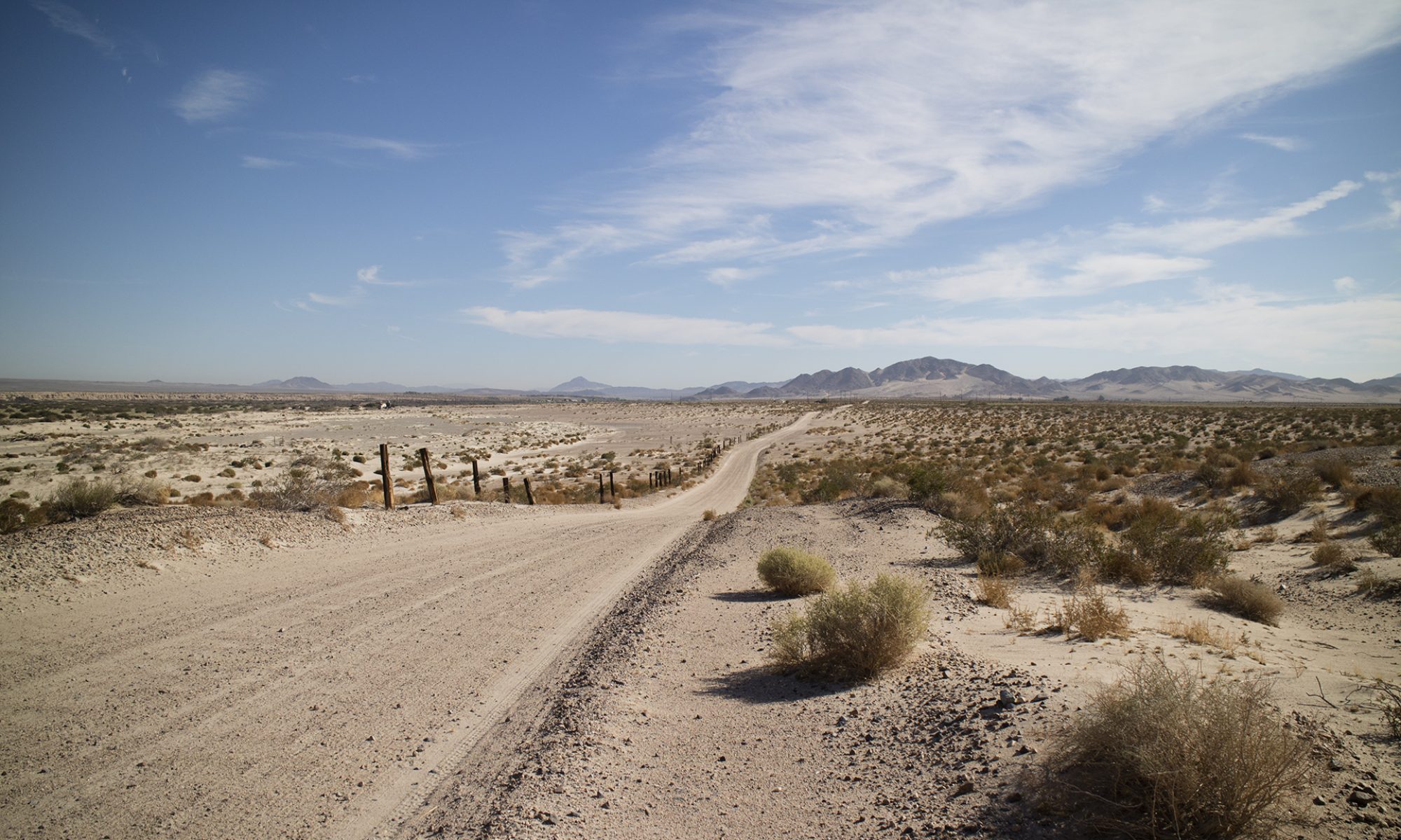
Trying to find the road to the Barnett Prospect. Going up the wash that blew out the road. And the road only went so far, the last geologist says you have to hike the final mile. #inyocounty #desert#geology#rocks#mojavedesert #desertwash #mining

A post shared by Tom Farley (@tgfarley) on


View this post on Instagram

Further up the wash. #mining#inyocounty#explore#geology#mines#mojavedesert rocks#desert# desert wash

A post shared by Tom Farley (@tgfarley) on


View this post on Instagram

Difficult hiking because everything underfoot is moving. #desertwash#mojavedesert #mining#geology #inyocounty#mines

A post shared by Tom Farley (@tgfarley) on


View this post on Instagram

Further up the canyon like wash. Should have taken a longer route to avoid this nonsense. #geologyrocks #geology #hiking #mining #desertwash#rocks#mines#inyocounty#explore#madness #inyocounty

A post shared by Tom Farley (@tgfarley) on


View this post on Instagram

Made it to the end of the road the hard way. They drove this far and then the literature says they went up by foot. #geology #roadtrip #hiking #inyocounty#prospecting#desertwash#oldmines#mining#explore#inyocounty

A post shared by Tom Farley (@tgfarley) on


View this post on Instagram

The Barnett Prospect will wait for another day. #hiking #trails#mines#exploremore #inyocounty#explore#geology#

A post shared by Tom Farley (@tgfarley) on


View this post on Instagram

A well defined boundary between gravel and rock on the upside of the hill, and far, far less gravel on the slope below. You can clearly see where the darker material starts. Limestone rock below the boundary not rolled or smooth. Update. This border is visible on Google Earth. #geology#deathvalleyregion#mines#inyocounty#mojavedeserttortoise

A post shared by Tom Farley (@tgfarley) on


View this post on Instagram

Found one more of these crazy rocks I can’t identify. Mohs scale of three so it wouldn’t polish that well. This is shown wet. Looks like porphyritic diabase and hardly fizzes but I am still unsure. Marine rocks everywhere, limestone, quartzite, you know the list. Guesses?#rocks#hiking#explore#getoutside##geology#geologistonboard#inyocounty#limestone#rockidentification

A post shared by Tom Farley (@tgfarley) on


August 27, 2023 - Pahrump to Barstow

August 27, 2023 - Pahrump to Barstow

Long day but I found a number of interesting places to explore or hound on my trip. Real work will begin when temperatures fall into the 90s or below. Today, at least on the stretch between Baker and Shoshone driving home, temps were 103 to 109 degrees Fahrenheit. 

The next time I travel the desert I will take plastic tubs to fill with water for desperate wildlife. I stopped at one place along the road and a bedraggled bird appeared from nowhere. It went straight under my truck, I thought for shade, but it was clearly wanting water. I left some in a small reservoir I fashioned from a plastic bag.

I’ll take more water for other people, too, not just myself. I noticed a big rig idling at a turnout with its emergency triangles in place. A breakdown. The driver had the engine running and the air conditioning must have been going. I approached. The driver said she was fine but eagerly accepted the bottle of cold water I offered her. Even with air conditioning, it is very uncomfortable to be thirsty in the desert. Very. At another time, I was walking back to my vehicle after doing some photography. A California Highway Patrolman slowed down to ask if I was OK. I said I was fine, thanked him, and waved him on.

With these kind of temps, and rural driving in general, I like to wave at every vehicle. If you’re not the friendly type, get friendly for remote places. This will help you and others, we all need to watch out for each other.

317 total miles.

These are just some of the things I saw. The highlight of the trip was talking to Don DePue of Diamond Pacific Tool in Barstow. We met outside after I got the three gallons of rock saw oil I had ordered a few days before.

View this post on Instagram

The Twenty Mule Teams started here! #borax#deathvalley#tecopa#mules#mining#roadtrip#geology#inyocounty#history

A post shared by Tom Farley (@tgfarley) on


View this post on Instagram

Some still photos of the area of the Amargosa Borax Works’ site near Tecopa, CA. This is where the 20 Mule Teams loaded up for their one hundred mile trip to Dagget. As the sign says, there was another deposit of borate minerals in Death Valley itself. Look for the video I did of this place earlier in the day. #tecopa#shoshone#inyocountytourism #geology#mining#mojavedesert #mojave#mules

A post shared by Tom Farley (@tgfarley) on


View this post on Instagram

Dumont Dunes OHV recreation area. Sand dunes. #desert#mojave#ohv#sandunes#desert#roadtrip#geology

A post shared by Tom Farley (@tgfarley) on


View this post on Instagram

Baker, CA. Highway town. One way to get to Death Valley. NOTE: Hotel may be out of business! deathvalley#bakercalifornia #roadtrip#freewayattractions #roadtrip

A post shared by Tom Farley (@tgfarley) on


View this post on Instagram

Your Ibex Pass footage for the day, complete with truck. You’re welcome. 2,072 feet. The Pass marks a border point between Inyo and San Bernardino County. Death Valley Park nearby. #inyocounty#roadtrip#mojavedesert #desert#shoshone#tecopa

A post shared by Tom Farley (@tgfarley) on

BLM Wilderness Area Collecting Rules

Collecting in a BLM or USFS WA is generally allowed unless a Resource Management Plan for that area prohibits it. These RMPs are constantly changing so there may be disagreement in the field when you meet someone in authority. Mostly, WAs are closed that have such things as native artifacts or petroglyphs.

BLM is pretty good online at stating which WAs are expressly closed, however, they often state that a WA is closed when in fact it is open. Look at their literature for a WA in any BLM field office, it will often contradict what they say online. BLM tells people to follow the “Leave No Trace” set of principles which are actually an ethos and not a force of law, unless the RMP incorporates them as a rule of law for a WA. Again, Leave No Trace is _not_incorporated into the Wilderness Act or existing nationwide BLM policy manuals.

As you can see by this letter, BLM CA headquarters owns up to collecting and so does the USFS. I can post an image of that letter later.

A Quick Two Hours in The North Nopah

Last week I discovered some outbuildings to an old mine on the east side of this particular hill in the North Nopah WA. Today, I was trying to find some clues to the west side claims that make up the old Nopah Group. No luck today, the heat too great to stay out too long.

View this post on Instagram

A little video and some stills of a quick hike into the North Nopah WA this morning. #geology #roadtrip #quartz #hiking #rocks#rockhounding#inyocounty#pahrump#mines#minerals#explore#getoutdoors#mojavedesertcalifornia

A post shared by Tom Farley (@tgfarley) on


View this post on Instagram

I always want to climb into canyons, even if they dead end, take hours to explore, or prove nearly impossible to come back down. #mojavedesert #quartz #rockhound #hiking #roadtrip#inyocounty#mining#prospecting #nopahwilderness

A post shared by Tom Farley (@tgfarley) on


View this post on Instagram

Pretty country when it’s not trying to kill you. #mojavedesert #prospecting #geology #hiking #rocks#inyocounty#roadtrip#pahrump#geologyrocks#limestone #nopahwilderness

A post shared by Tom Farley (@tgfarley) on


View this post on Instagram

Last notes for today from the field. Quartzite shown dry in the video, dry and wet in the still photos. #geology #quartz #rockhound #hiking #explore#lapidary#mojave#mojavedesert#pahrump#explore#inyocounty#nopahwilderness #

A post shared by Tom Farley (@tgfarley) on