My eyes are good enough to cut and paste links if I wear my sunglasses at the screen:
View this post on Instagram
A post shared by Tom Farley (@tgfarley)
—
View this post on Instagram
A post shared by Tom Farley (@tgfarley)
—
View this post on Instagram
A post shared by Tom Farley (@tgfarley)
—
View this post on Instagram
A post shared by Tom Farley (@tgfarley)
==
View this post on Instagram
A post shared by Tom Farley (@tgfarley)
—
View this post on Instagram
A post shared by Tom Farley (@tgfarley)
—
View this post on Instagram
A post shared by Tom Farley (@tgfarley)
—
View this post on Instagram
A post shared by Tom Farley (@tgfarley)
—
View this post on Instagram
A post shared by Tom Farley (@tgfarley)
—
View this post on Instagram
A post shared by Tom Farley (@tgfarley)
—
View this post on Instagram
A post shared by Tom Farley (@tgfarley)
—
View this post on Instagram
A post shared by Tom Farley (@tgfarley)
—
View this post on Instagram
A post shared by Tom Farley (@tgfarley)
—
Excellent tour of the the Baxter Mine on YouTube. Comes complete with the requisite twangy banjo music that is on every prospecting or Old West adventure video..
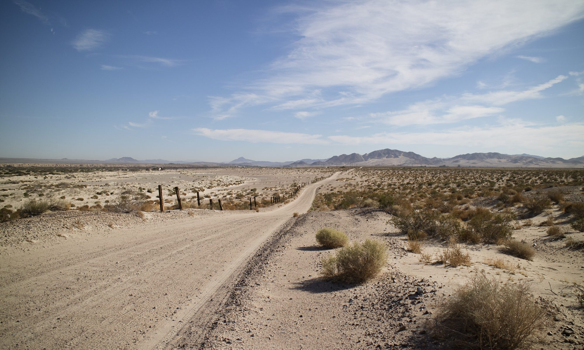
When it gets above 100 degrees (37 Celsius), I focus more on reconnaissance than mining. Of course, if there is a decent amount of gold somewhere, then things change immediately. Let me stay, though, with what I do more often in the summer: look for promising areas I can come back to later and do a little light collecting at the same time.
My hikes are shorter, far earlier in the morning, with a cutoff or return time to the trailhead of noon or just a little later.
Most areas I am now hiking have absolutely no shade unless you can find a friendly tunnel you can slip into. Good luck with that, especially in areas with little mining history.
Sunglasses
Sunglasses are absolutely imperative. They must wrap around the side of your eyes or you will be a hurting puppy. Years ago I had a pair of glacier glasses like this and they were extremely expensive. These Vaurnets will now run you $280!
— Much better for those of us who wear regular glasses already are these big glasses, sometimes called “Glaucoma Glasses.”
These are usually $25 to $30 in many grocery and pharmacy stores. You can get them in a darker shade. You can treat them roughly in the field and not cry when they break. If they break. I’ve had lenses pop out of them from time to time and they pop right back in. These scratch fairly easily but, again, this is field work you are doing and when you want to see something clearly, you’ll take them off. Again, it’s the side shielding that’s important
You can buy ten of these for what those Vaurnets will cost you. You can buy those the next time you attempt Everest. Although I haven’t checked, I am sure marine and boating supply stores may have good choices as well. Expect, though, to pay handsomely for anything connected to sea going.
Clothing
Here’s what I generally look like on the desert. Full coverage, heavy sunglasses, a cap with a bandana or a cap with a tail. In this case, I didn’t have my regular cap. I like everything produced by Pacific Dorfman. (unsponsored link) You can make a ball cap work, though, with a bandana. If I want to protect my hands from the sun I may wear gloves with open fingers. Gloves also help you slide over rocks if you are scrambling. Know, though, that every rock in the desert has some small and invisible thorns blown onto the rock from somewhere.
—
Notice that I am overweight. That’s not too important if you are in good hiking condition. I am 62, too heavy, and have a bad left leg. But I can manage in the summer just fine, even if I can only hike with light weight. With the right clothing, good boots, and enough water, you can manage, too.
Water
There’s a certain look to long distance hikers. I watch out for anyone who shows up on a long, hot hike without that look. Too much skin showing, shorts, perhaps a short-sleeve shirt. This is crazy clothing for the desert and I know I am going to be offering them water along the way and sunscreen. Sometimes, I almost force these things on people. I generally get two reactions.
If I encounter a couple in the middle of nowhere who are dressed inappropriately and look tired, I will offer them some water. If it’s a man and a woman, the guy invariably hesitates while the woman will look eagerly at the offering. It’s a macho thing, I suppose, and something that gets people killed. If they seem slow to answer, make sure you ask them if they need help. If they turn you down, note their location in case they slip into heat exhaustion later on. An SAR crew may be eventually looking for them. If they need help then drop everything you are doing to help them get out Don’t just make a phone call if you are in cell phone range, stay with them until you can get them back to services or until assistance arrives
Take water, take lots of water. Cache it along the way if you have been in the area before and you know with absolute certainty that you are coming back on the same trail. No sense packing up all your water up a steep hill, only to bring it all the way back down.
Bladders are far preferable for hiking when you are putting on lots of miles and not stopping. If you are making a number of stops, you can get by with individual water bottles since you will be constantly into your pack. Still, a bladder encourages drinking more water by having it available right at your mouth. You will drink more with a bladder. I’ve used Camebackl products but have no favorite anymore. All leak at some point, usually where you screw down the connection to the bag. I carry bladders in the truck upside down before a hike so there is little chance of them leaking beforehand. Many people carry seven or eight ounces of reserve water in a bottle in case of a leak on the trail or a kink in a hose that lets water continue to flow out. All of us have had the sickening feeling of a backpack and shirt suddenly soaked with water from a leaking bladder.
Clothing
I prefer heavier clothing when mining but for exploring and recon, lightweight nylon is really the way to go. It isn’t cheap but the better brands are more durable than you might think. I long resisted nylon because it had to be hotter than cotton. Which it is, in a way.
Tight fitting nylon shirts are indeed uncomfortable. Loose fitting nylon is much more comfortable and on a hot desert day you can pour water on your shirt to cool you down. That’s unlike cotton where the same trick will instead result in a clammy piece of clothing stuck to your back, taking forever to dry off. Full coverage pants and shirts reduce or eliminate the need for sunscreen, as much of this clothing has SPF ratings starting in the high 40s.
I like Columbia gear and I save money by buying at their discount stores or at Marshalls or other discount outlets. It takes searching to find any good clothing on discount, never-the-less, bargains are out there. If you are shopping for the next weekend, you’ll be out of luck. But if you shop throughout the year you will pick up good clothing at a good price. It may be an odd color but it will be less expensive.
I avoid REI except for their discount racks. Their house brand is excellent as well as the Mountain Hardware and North Face brands, but the best value for money remains Columbia. My friend says Columbia makes little in larger sizes for women.
Belts
Accessory belts are the worst. Make sure any pants you buy have a dead simple and lightweight belt system. Do not get a belt to fit the pant. They are all wrong, they hang down, they get in the way, they are complicated. Just make sure the belt comes with the pants.
Boots
Despite their vulnerability to thorns, canvas and nylon boots rule the day in the desert. Unless you are mining with heavy tools, full leather boots are just too hot over 100 degrees. Some brands may make Kevlar constructed boots these days, I don’t know. Nylon and canvas boots do not wear in, they are as comfortable as they are going to be the minute you put them on. Or as uncomfortable. The real trick with boots is to buy an expensive insole called Superfeet. (unsponsored link) Get the green color. They will cost as least $60, last no more than a year, and are worth every penny. They will most probably cure or reduce any strange foot pain with your sole that you’ve been having. I have them in every one of my shoes as well as my boots. Bootlaces break before your boots will.
The unhappy part of every hiker’s life is when their boots give out and they have to find a new pair. You won’t find your old model when you go looking. I guarantee it. Well made leather boots can be resoled at great expense, I gave up on my my very comfortable leather Pivetta Italian Hiking boots when new soles cost over $100 each year. And you need to find a good bookmaker
Socks.
Keep a dedicated pair or two for your boots, don’t bring them inside the house except to wash them. Always keep them with your boots in your vehicle. You never know when a distant peak calls and you must go. Have them ready. Lightweight, good quality wool is not scratchy and very comfortable. Think of a cashmere sweater, that is not scratchy wool. Problem is finding those comfortable wool socks. Don’t ever think of using cotton, it gets wet and rubs and will blister you far quicker than any other material.
Darn Tough socks are the best I have ever had. (unsponsored link). For three years now I have worn their everyday socks for my everyday wear here in Las Vegas. Yes, wool socks for 100 to 115 degree temps. This is not as odd as you might think, all the old school cyclists back in the 1960s and 1970s wore Merino wool jerseys and shorts. Far more comfortable than cotton and a Merino wool jersey is actually comfortable and a little warmth in a rain when temps are in the 50s to 60s. —
Packs
Every pack has a loop at the top . Add a locking carabiner to it. You can now carry all sorts of things when needed, like another backpack or ore commonly, some clothing to dry out or perhaps a tripod. Things will swing wildly from it but this is usually for short term use. I don’t use luggage when I have to fly, I use backpacks, sometimes tied together with the biner for a short while. Get a real, climbing rated biner on the very remote chance you may need one and find you that you have instead a toy biner. Daypacks should have a chest strap and a waitsbelt to better carry weight
That’s it for today, more later. I am moving to Pahrump, Nevada. Furniture moves in two days and it is chaos here.
I hope you and yours are well and safe. Nevadans are still free to move about the state, even here in Las Vegas in Clark County. As such, I am getting out as much as I can while I can.
With many of you staying at home, I will be posting much more often. In addition to reporting on whatever day trips I take now, I will be posting photographs from my travels across the Southwest that I have taken over the last three years. They won’t be well processed or described in too much detail (this is the greatest time killer with photography) but they will be something interesting to look at. Until my server space runs out, these will be full size images that you can download and use in any way you like without a need to credit me or worry about copyright restrictions.
As far as my health, I badly wrenched my back two weeks ago while working on my truck. I took aspirin for two days and then admitted defeat by turning myself into an Emergency Room at three in the morning. Since then I have visited three more medical facilities, each time getting good care but also exposing myself to whatever might be in the air. It’s a bit worrisome.
My injury somehow produces pain from my lower back to the sole of my left foot. I have no pain for ninety percent of the time unless I move the wrong way. Walking around and staying active helps if I am careful. Somehow, I can still do cautious, slow hiking up hills without much discomfort. I don’t understand this. On the other hand, I stiffen up so much at night that when I get out of bed in the morning I am screaming in pain. Literally. I have an appointment with a physical therapist soon.
What else?
My book project is taking up too much of my time and patience. I am a perfectionist and I wanted this hardcopy book to look a certain way and to be in a spiral bound format to lay flat. Bringing this about has caused me to waste too much time indoors. As such, I will be roughly formatting the document and then releasing it for free, chapter by chapter. The Arizona chapter is 70 pages by itself. I don’t know whether I will put it out as a .pdf or a Word doc. I will be locking down the content in some form, my one restriction for the time and effort it has taken to produce this writing.
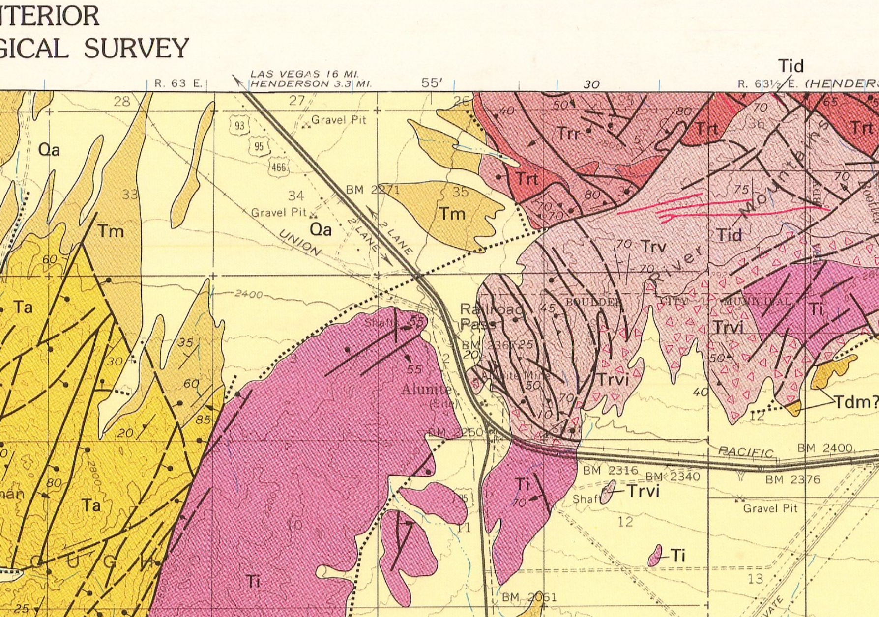
I’m going to try to get back to Railroad Pass today to try to source some andesite for a friend who is looking for it. Unfortunately, it may not be there, despite the simple geological map that I was using previously from Macrostrat.org. I pulled the official USGS geological map for the area and the real outcroppings of andesite are miles distant and off pavement. See the image below, “Ta” stands for andesite. Scattered occurrences of andesite may occur at Railroad Pass since maps cannot locate every rock. But again, andesite is quite a bit away and I shouldn’t go off pavement too far since I can no longer change a tire on my own. I also have other reasons to return to Mountain Pass which I will detail later.
I hope all of you are well and safe.
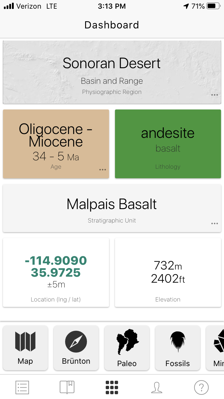
— This is Macrostrat’s simplified description of the hill I was on at Railroad Pass. —
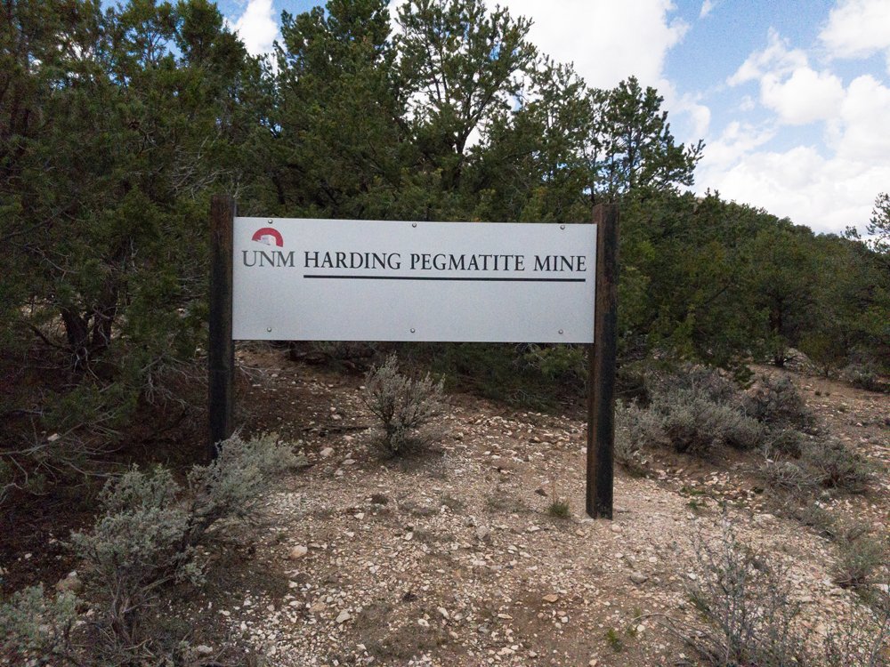
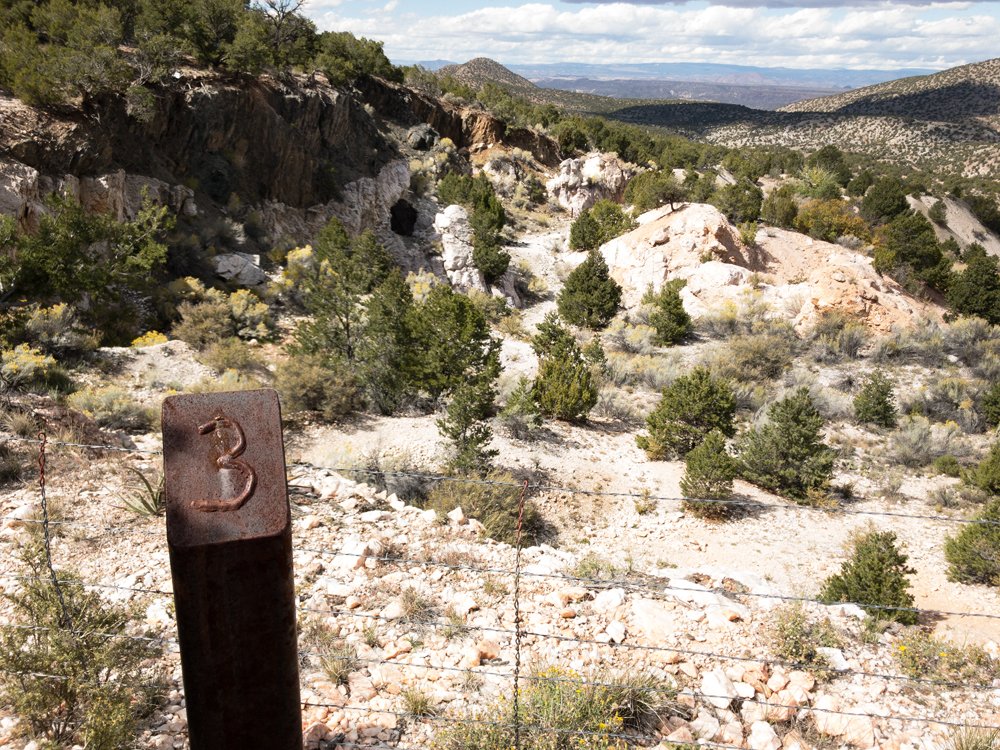
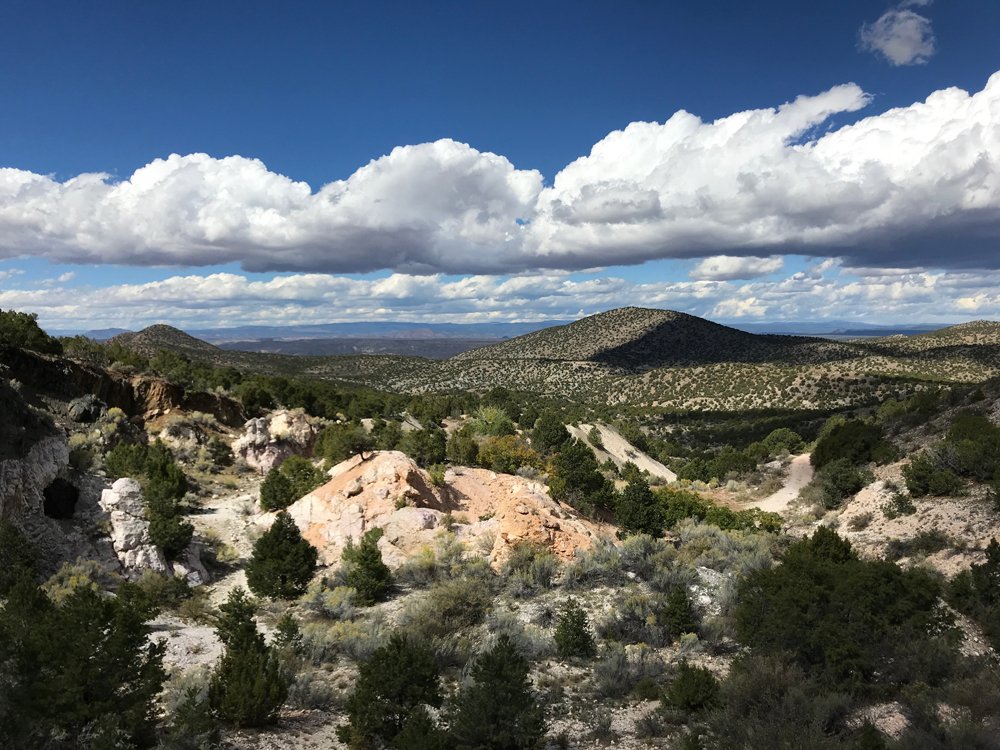
Harding Pegmatite Mine
Random photos of the Harding Pegmatite Mine in Taos County, New Mexico. Some of these might have been posted before, some of them may have been downsized at one time. Follow the link I just gave, many more details there. More pictures to come.
— — — — — — — — Visitation rights are now subject to change because of the virus. Check the University’s websites. And check my current places to visit travel list for attractions around the area. Subject to when we can all travel again, of course, and with the hope our rock shops have not gone out of business.
Harding Pegmatite Mine
Between Taos and Santa Fe along NM 75. Bring all your maps.
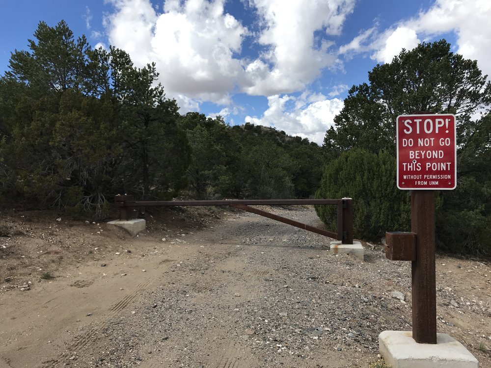
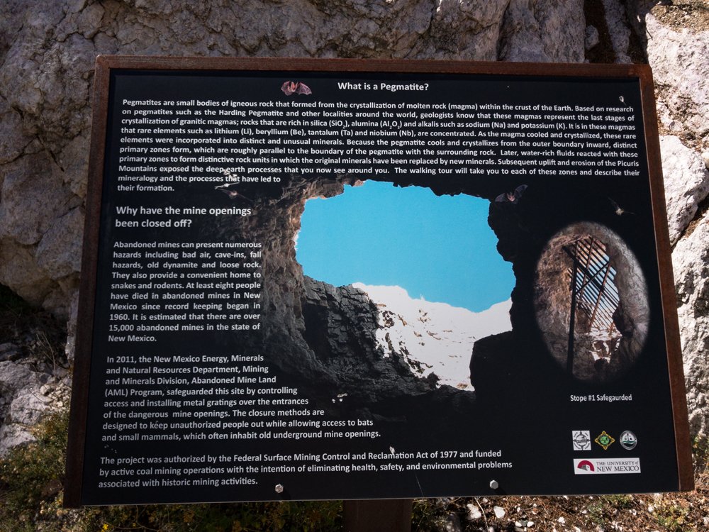
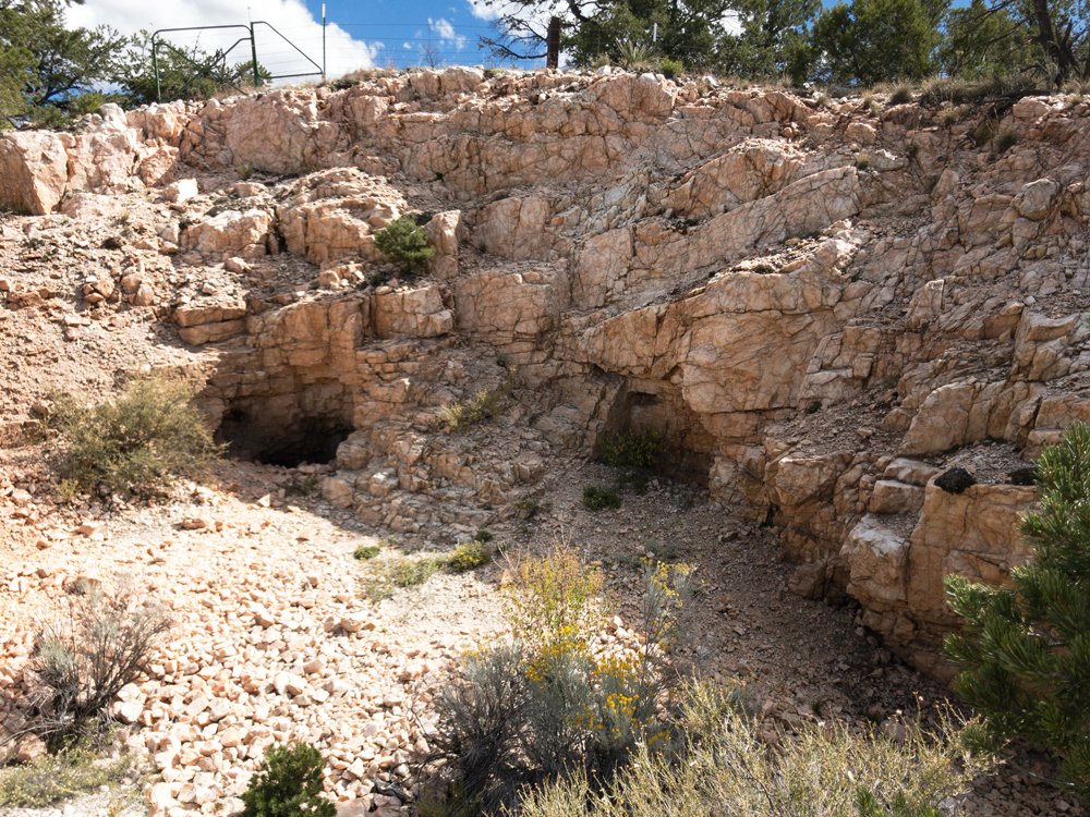
The Harding Pegmatite Mine is a former rare minerals quarry located in Taos County. Now maintained by the University of New Mexico, the Pegmatite Mine is open to rockhounds for no fee. Five pounds of material may be taken provided guidelines are followed. Large groups must pay a fee and they need to call ahead.
Visitors must fill out a release form available at the mine’s website. Follow the University’s instructions exactly as it will be necessary to fetch the caretaker before entering the mine. The road to the first mine gate is short and passable by passenger vehicles. Parking is extremely limited at this first gate. No trailers or RVs. If the gate is open, a larger parking lot is farther along the road.
Pegmatites are unusual and interesting rocks igneous rocks, originating from volcanic activity. At the Harding Mine, white sparkling rock is all around, some with pink tints, often with gray or darker inclusions. The pegmatite is the white rock, the various colors and inclusions the minerals. These can be quite unusual, needing an expert to identify them. Bityite, eucryptite, and fluorapatite are some. More common is the pink tinged lepidolite.
A lepidolite tinged rock showing nice pink coloring is a challenging but satisfying project on a warm day in the beautiful hill country of Taos. If possible, bring a short wave and longwave lamp, along with a barbecue lid cover. Hunting fluorescent rocks enlarges searching beyond what appears in daylight.
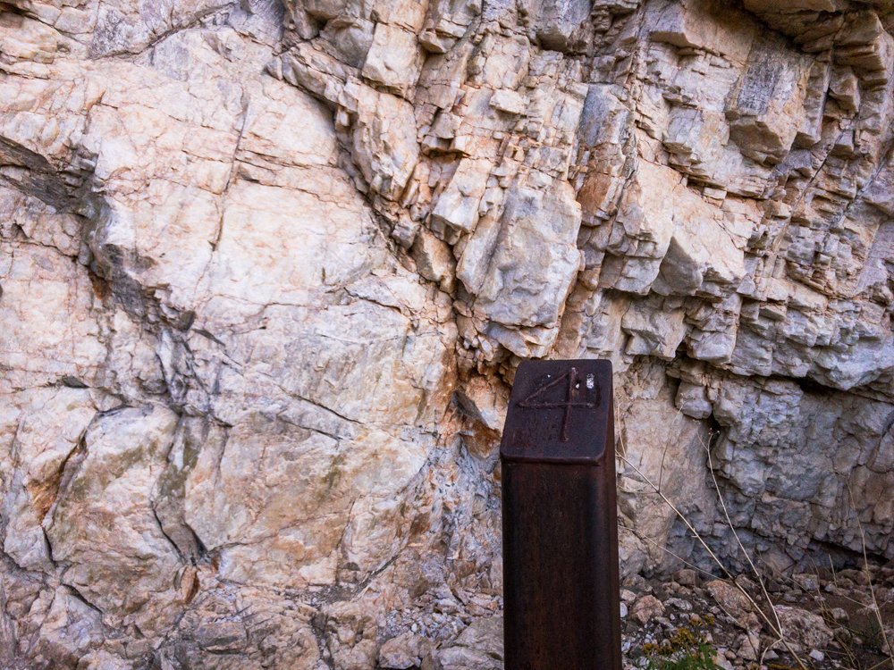
Print the “Walking Tour for the Harding Pegmatite Mine” file before visiting. It references the numbered markers that are spotted about the quarry.
If possible, a tour of the old quarry should start at the University of New Mexico in Albuquerque in Northrop Hall, home to UNM’s Department of Earth & Planetary Sciences. A museum in Room 124 displays specimens from the mine. A dimly lit case on the first floor also exhibits specimens, including a large chunk of beryl. In that case, notice how one rock seems to intergrade with others. The rose muscovite, the lepidolite, and the spodumene all seem variations on a theme. What’s not obvious is the sparkling nature of some of the rocks, which comes into play in bright light.
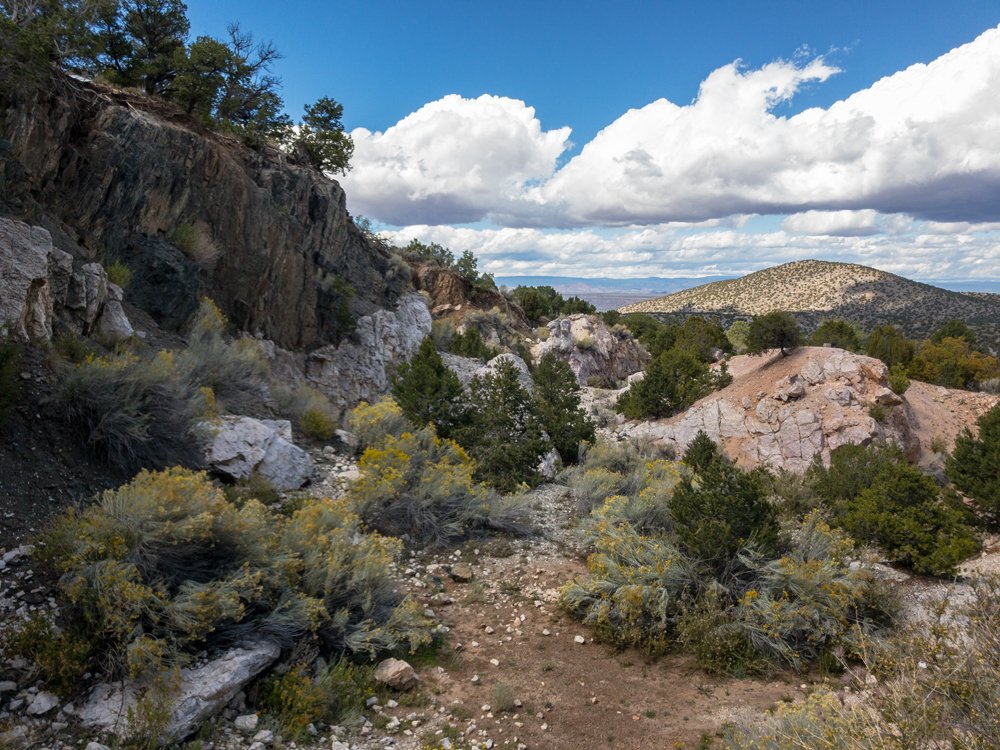
The mine’s entrance off Highway 75 is on a strong uphill grade and is difficult to find. There is no sign indicating the mine road, save for a small wood plaque on a juniper asking people to pack out their trash. On a fair day, you will be caught up in looking at the surrounding countryside. This is the land D.H. Lawrence fell in love with and you will, too.
36°11.890′ N 105°47.346′ W
This link is for the mine tour.pdf and the release form:
http://epswww.unm.edu/harding-mine/
The Taos hill country is populated with artist studios, wineries, and scattered Indian Pueblos. Cottonwoods in the fall blaze yellow along streams and other watercourses. It is a delight in fair weather. Iceland spar may still exist in the area, check Mindat.org for possible locations and MyLandMatters.org for land status. — https://www.instagram.com/tgfarley/ Follow me on Instagram: tgfarley
I’ve been bothered for years that I don’t have the time or patience to develop a course or a series of videos explaining the Public Land Survey System or PLSS. It is a living antique used everyday.
This country was never laid out by latitude and longitude, something that would make it easy today to tell where a claim or an old townsite is. Instead, we file a claim in 2020 using elements like meridians, townships, ranges, sections, and so on.
Variously called land descriptions, legal descriptions, and a host of others, the PLSS is a survey system used to locate or delineate a piece of real property. Everything about the PLSS is obscure or arcane.
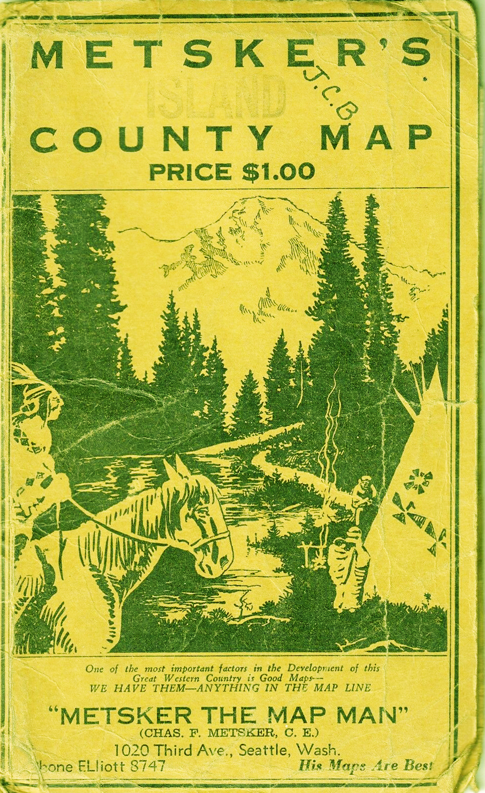
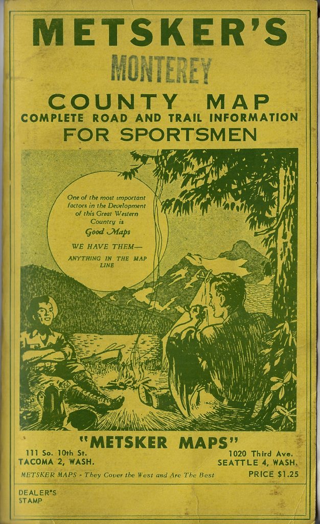
While you are reading up on the subject, my best suggestion is to get a few used Metsker’s Maps. They show all of the PLSS elements at work, often on heavy paper with distinct blue lines. Find them on eBay.
These maps were made for outdoorsmen who camped, hiked, and prospected old school. A compass, a backup compass, and good maps. Topos were and are essential as well, but you also have to know where you are in survey sense, not just a terrain sense.
I do have a lot of materials developed on the PLSS but it is such a burden of time that I simply can’t get to it right now.
Acting on a non-ferrous signal from a rock in a wash near Lathrop Wells, Nevada, I moved upstream to see if I could find the source of whatever metal was causing my detector to ring out.
There were no records of any commercial mines in the Striped Hills near Lathrop Wells, however, there were passing mentions of old copper prospects in the area. These are limestone hills and I didn’t think of them as producing any metallic ore from uplifted seabeds. Where would copper come from by way of calcium carbonate shells and the skeletons of ancient sea creatures?
— Update: Actually, there are carbonate or sedimentary based minerals like azurite and malachite in the copper group can definitely arise in a sedimentary location, given the right conditions. As RC with Geological Specimen Supply explained to me, “Limestone against granitics often gives rise to a contact deposit. If the granitic is quartz monzonite, the mineralization is often copper.”
— Update: Another contact deposit appears to have happened at the Yellow Pine Mine in the Goodsprings District in Clark County, Nevada. The Yellow Pine is a world class locality for hydrozincite. It was there a friend and I conducted a nighttime fluorescent mineral hunt with great success.
There were some volcanics in the area as I noticed when I first got out of my truck. Quartz pieces were scattered here and there. Most quartz arises from or is related to volcanic activity.
These exploratory diggings proved very difficult to find as the road to them had long been cut to pieces by countless desert storms over the decades. An ATV might make it in, but first you have to know where you are going. To find out, I set out hiking on foot with my tools, just as I have done with most of my gold prospecting.
I had GPS coordinates for some of these ancient claims but a GPS fix on an old mine is likely a conversion from the Public Land Survey System which does not use latitude and longitude. That means you will probably wind up in the middle of a claim area, which could be twenty acres in size, not at any particular excavation or tunnel entrance.
The result was that I spent three half-days hiking up and down over many steep hills and on treacherously slippery, broken rock. This was mostly highly fractured quartzsite, a metamorphic altered from slate and before that shale. All first arising from ancient seabeds now raised up. Tough. Seen tougher.
I eventually found some pretty rocks as the last picture shows, however, all of them are essentially deposits like chrysocolla. The greener material leans toward malachite and chrysocolla, the bluer toward azurite. There is an extremely small amount of copper infused quartz. Nothing I found rang out like what I found in the desert wash that drains this area. By way of comparison, the copper mineral group member bornite definitely rings my detector as well as, of course, native copper.
I noticed a tremendous amount of black sand on the hills I hiked. All of it proved sterile when I processed two buckets of sand and gravel. To be fair, I didn’t have any fire assayed so I don’t know for sure. Processing microscopic gold, however, is for large scale operators. I will be back, though, if not for the minerals, then for the peace and quiet.
—
— — — — — — — — — https://www.instagram.com/tgfarley/ Follow me on Instagram: tgfarley


 Packs
Packs