August 27, 2023 - Pahrump to Barstow

August 27, 2023 - Pahrump to Barstow

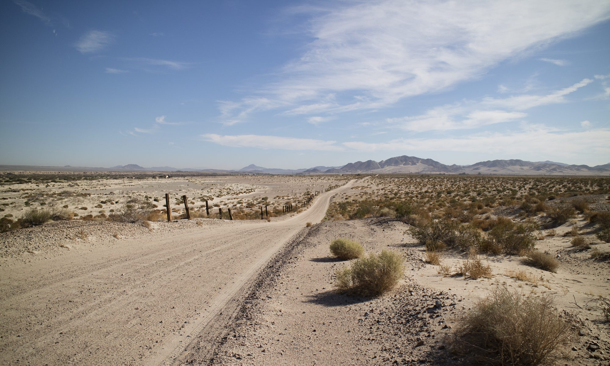
Long day but I found a number of interesting places to explore or hound on my trip. Real work will begin when temperatures fall into the 90s or below. Today, at least on the stretch between Baker and Shoshone driving home, temps were 103 to 109 degrees Fahrenheit. 

The next time I travel the desert I will take plastic tubs to fill with water for desperate wildlife. I stopped at one place along the road and a bedraggled bird appeared from nowhere. It went straight under my truck, I thought for shade, but it was clearly wanting water. I left some in a small reservoir I fashioned from a plastic bag.

I’ll take more water for other people, too, not just myself. I noticed a big rig idling at a turnout with its emergency triangles in place. A breakdown. The driver had the engine running and the air conditioning must have been going. I approached. The driver said she was fine but eagerly accepted the bottle of cold water I offered her. Even with air conditioning, it is very uncomfortable to be thirsty in the desert. Very. At another time, I was walking back to my vehicle after doing some photography. A California Highway Patrolman slowed down to ask if I was OK. I said I was fine, thanked him, and waved him on.

With these kind of temps, and rural driving in general, I like to wave at every vehicle. If you’re not the friendly type, get friendly for remote places. This will help you and others, we all need to watch out for each other.

317 total miles.

These are just some of the things I saw. The highlight of the trip was talking to Don DePue of Diamond Pacific Tool in Barstow. We met outside after I got the three gallons of rock saw oil I had ordered a few days before.

View this post on Instagram

The Twenty Mule Teams started here! #borax#deathvalley#tecopa#mules#mining#roadtrip#geology#inyocounty#history

A post shared by Tom Farley (@tgfarley) on


View this post on Instagram

Some still photos of the area of the Amargosa Borax Works’ site near Tecopa, CA. This is where the 20 Mule Teams loaded up for their one hundred mile trip to Dagget. As the sign says, there was another deposit of borate minerals in Death Valley itself. Look for the video I did of this place earlier in the day. #tecopa#shoshone#inyocountytourism #geology#mining#mojavedesert #mojave#mules

A post shared by Tom Farley (@tgfarley) on


View this post on Instagram

Dumont Dunes OHV recreation area. Sand dunes. #desert#mojave#ohv#sandunes#desert#roadtrip#geology

A post shared by Tom Farley (@tgfarley) on


View this post on Instagram

Baker, CA. Highway town. One way to get to Death Valley. NOTE: Hotel may be out of business! deathvalley#bakercalifornia #roadtrip#freewayattractions #roadtrip

A post shared by Tom Farley (@tgfarley) on


View this post on Instagram

Your Ibex Pass footage for the day, complete with truck. You’re welcome. 2,072 feet. The Pass marks a border point between Inyo and San Bernardino County. Death Valley Park nearby. #inyocounty#roadtrip#mojavedesert #desert#shoshone#tecopa

A post shared by Tom Farley (@tgfarley) on

A Quick Two Hours in The North Nopah

Last week I discovered some outbuildings to an old mine on the east side of this particular hill in the North Nopah WA. Today, I was trying to find some clues to the west side claims that make up the old Nopah Group. No luck today, the heat too great to stay out too long.

View this post on Instagram

A little video and some stills of a quick hike into the North Nopah WA this morning. #geology #roadtrip #quartz #hiking #rocks#rockhounding#inyocounty#pahrump#mines#minerals#explore#getoutdoors#mojavedesertcalifornia

A post shared by Tom Farley (@tgfarley) on


View this post on Instagram

I always want to climb into canyons, even if they dead end, take hours to explore, or prove nearly impossible to come back down. #mojavedesert #quartz #rockhound #hiking #roadtrip#inyocounty#mining#prospecting #nopahwilderness

A post shared by Tom Farley (@tgfarley) on


View this post on Instagram

Pretty country when it’s not trying to kill you. #mojavedesert #prospecting #geology #hiking #rocks#inyocounty#roadtrip#pahrump#geologyrocks#limestone #nopahwilderness

A post shared by Tom Farley (@tgfarley) on


View this post on Instagram

Last notes for today from the field. Quartzite shown dry in the video, dry and wet in the still photos. #geology #quartz #rockhound #hiking #explore#lapidary#mojave#mojavedesert#pahrump#explore#inyocounty#nopahwilderness #

A post shared by Tom Farley (@tgfarley) on


Two Minutes Walking in A Desert Wash

I’m documenting some different things at Wikimedia Commons for anyone to view or use.

Wikmedia Commons uses an odd video file format that may not play on your device. It’s called .webm. These videos open and operate reliably in the Firefox broswer, my iPad, but not my iPhone.

Editing or otherwise working with a Wikimedia Commons hosted video may prove fruitless unless you have a commercial converter. I use Movavi products for all of my video work. They are very cheap compared to anything Adobe and are far simpler to use.


https://www.instagram.com/tgfarley/
Follow me on Instagram: tgfarley

Detecting on Desert Pavement

Desert pavement is a mix of stones and pebbles that looks like a parking lot made up of flattened gravel. Surface rocks are bound tightly together in a mosaic like pattern. Wind has scoured this rock and gravel of its sand and other lighter material over millions of years. Detecting should be considered if a great deal of quartz is present. Values should be better exposed than the nearby desert with its always present overburden of alluvium. Desert pavement is ecologically fragile and should never be driven on.

Detecting on Desert Pavement from Thomas Farley on Vimeo.


Photo of surrounding area. This is near HWY 160 and Crystal Road in southern Nye County, Nevada.


https://www.instagram.com/tgfarley/
Follow me on Instagram: tgfarley

Again Along the Spanish Trail

Important note from RC. The limestone comes first, not the calcite. In the post I have the process reversed.

Saturday, September 14, 2023

Picked up an odd rock today along the Old Spanish Trail, not far from the Junction of Highway 160. in Clark County, Nevada. What Macrostrat.org calls young fan alluvium. Lots of limestone and sandstone bits and pieces. Didn’t see anything like this rock. It has notable pockets around the rock and then lines of heavily marked material evenly radiating out from them.

There is chunk of what may be limestone at the bottom of each pocket. It reacts little to acid but I think I see some activity. The white material, less that 2 on the Mohs scale doesn’t react because it is so porous the acid soaks it up before doing anything! The white material fluoresces a strong orange/red while the pockmarked lines, full of circle and bubble shapes, does not do anything under UV.

It strikes me somewhat as being like the calcite material which I saw recently at the Kokoweef Cavern Mine complex. There are a few dead springs in the surrounding area, I am wondering if this has something to do with being formed or acted on by a spring. But I don’t know why these lines would radiate from those pockets. Or why there would be pockets in the first place.

September 16, 2023

I’ve been thinking this over by myself. No one on Mindat.org of FB has made any suggestions as to what formed the rock, other than it might be gypsum. Which it is not, much too soft for gypsum. I have a reference specimen of rock gypsum, unweathered, and a self-collected piece, weathered, from Shark Tooth Hill in Kern County, California. Both those rocks are chalky and too soft to compare with the mystery rock.

Here is my working theory. The white material is calcite, a mass of which formed around several limestone rocks. At some point the mass became tumbled and rounded in the small desert wash or channel that I collected it from. Being very absorbent, the round mass picked up rainwater which would contain carbon dioxide. A weak carbonic acid would develop when the limestone reacted to that. The limestone is now eating away at the calcite, dissolving the material over the centuries.

The pockets you see are all centered on where a piece of limestone is located. The residue seen in the lines is the acidic precipitate left by this slow destructive process. Thus, that residue or the limestone does not respond to UV, being limestone and limestone related, while the calcite (the white mass or host) responds to UV as most calcite does.


Under SW UV. Forgive the “blue bleed”, a common sight when photographing glowing rocks.


R.C. has just checked in. “If it’s calcite, no surprise. Rainwater dissolves limestone, which is calcite. Limestone typically has fractures which gradually get enlarged as rain water makes its way through. This is how cave systems form. The calcium carbonate (calcite) dissolved in the rainwater is what forms stalactites and stalagmites in caves, and it commonly fills in fractures between blocks of limestone.”

So, do we have a rock that was once a fractured piece of limestone, now with calcite accreting around the remaining pieces? In other words, this may not have been a mass of calcite to begin with, rather it was a block of limestone that started this all off. And then it transformed into what is seen today. Hmm. Still pondering.


Kokoweef material self-collected on mine dumps by permission. Limestone rock on top and “popcorn calcite” underneath, the calcite carbonate deposited in the form you see here. It is unknown whether this rock came from the cavern roof, its floor, or a wall.

This popcorn calcite responds weakly under SW, producing an uninteresting cream color. It does have a short but notable phosphorescence or afterglow.


——

Follow me on Instagram: tgfarley

https://www.instagram.com/tgfarley/