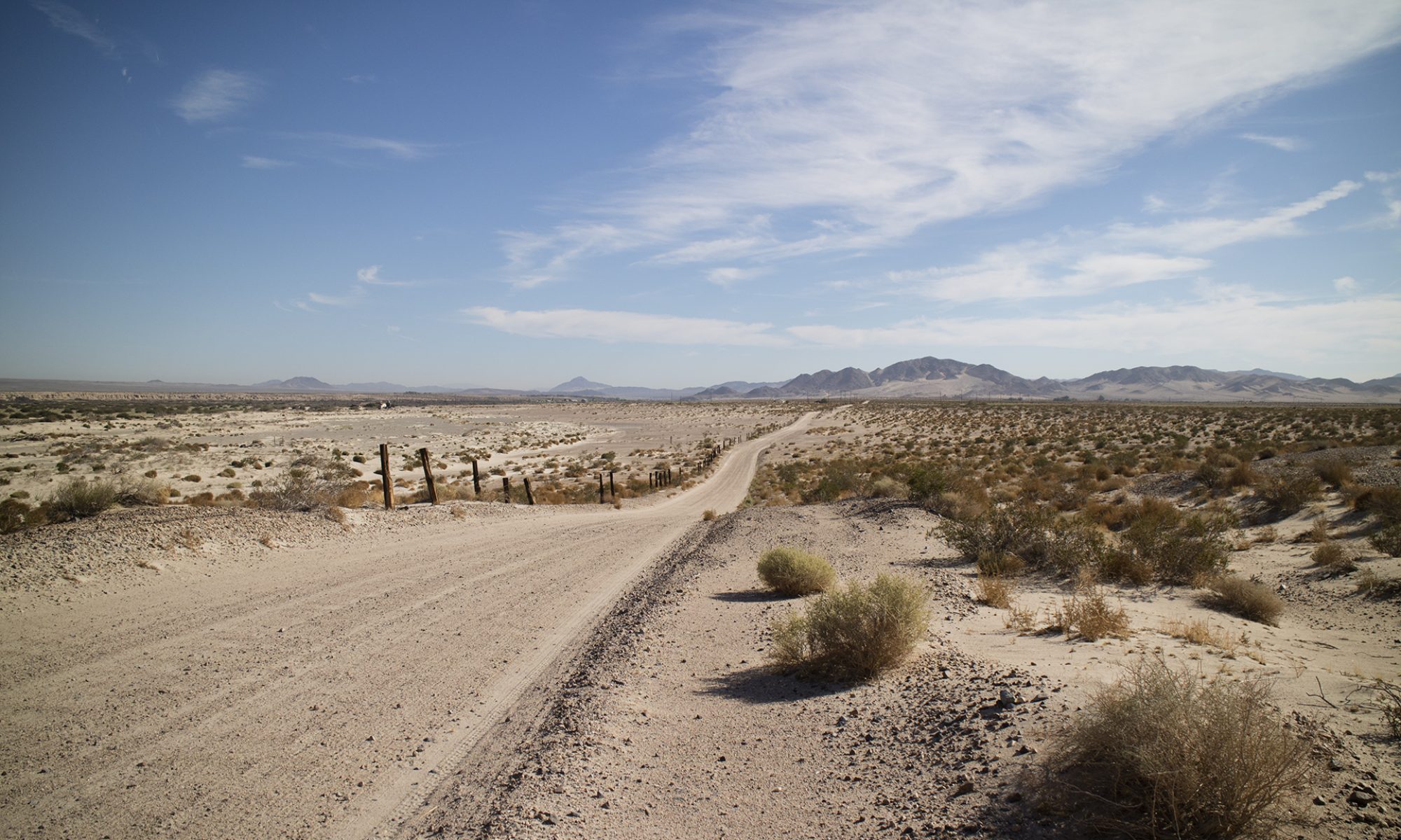
Nye and Inyo County

View this post on Instagram

Some of the drive in to the China Ranch Date Farm. Dash cam failed to record what may have been a gray fox crossing the road. I’ll get that camera figured out today. #chinaranchdatefarm #tecopa#geology roadtrip#inyocounty#nopahrange#roadtrip

A post shared by Tom Farley (@tgfarley) on


View this post on Instagram

Out in Inyo County, California today. This is a working date palm farm with a gift shop and a kitchen that makes baked goods and date shakes. Only a few miles from Immigrant a Pass in the South Nopah Range. #inyocounty#roadtrip#palmtrees#desertoasis #oasis#mojavedesert#tecopa#deathvalley

A post shared by Tom Farley (@tgfarley) on


View this post on Instagram

Gift shop at the farm. The parking lot is a trailhead for many hikes. We were the only ones there during our visit, the ranch is usually bustling with customers. #roadtrip#palmtrees#oasis#desert#armagosavalley #tecopa#deathvalley

A post shared by Tom Farley (@tgfarley) on


View this post on Instagram

At the Museum. Open after an 11 week shutdown ordered by our beloved governor. Some hands on exhibits still not operating, again, by order of a state government that knows what is best for us. #pahrump #roadtrip#nevada#rocks#yuccamountainproject #radiation#nyecounty#history#

A post shared by Tom Farley (@tgfarley) on


View this post on Instagram

Tuff. Learn it, live it, love it. #geology #roadtrip #geology rocks#volcanics #pahrump#museums#nyecounty#nevada#yuccamountainproject #rocks #tuff#

A post shared by Tom Farley (@tgfarley) on


View this post on Instagram

The quixotic town of Blue Diamond, named after the hill of the same name. Gypsum mine nearby. At the far south end of the Red Rock National Conservation Area. #gypsum#clarkcounty#bluediamondnevada #roadtrip

A post shared by Tom Farley (@tgfarley) on

It’s All About The Gram

An upcoming road trip will take me to Boron, California to stop in at Desert Treasures, if they are open. On the outskirts of Boron, the Rio Tinto Borax Mine Visitor Center is next and then on to Barstow to visit the Desert Discovery Center to view The Old Woman Meteorite. Then over the Tehacapi Pass to Bakersfield.

Next day to Shark Tooth Hill and The Ernst Quarries, next to Randsburg, and then on to Ridgecrest to visit Minerals Unlimited.

North after that to Death Valley, then east to Beatty, and then a drop back down to Las Vegas. I will be posting photos along the way if I have cell coverage.

If you are not on Instagram, consider joining. It’s all about the gram.

My username is: @tgfarley

On the web: https://www.instagram.com/tgfarley/

How Not to Travel to Death Valley

Last week while running in South Summerlin, which is on the west side of Las Vegas, I was stopped by a woman asking for directions. She had a strong foreign accent and the wind was blowing hard, making communicating difficult. She seemed to be asking for Valley View or Valley something, I couldn’t quite make it out. She kept glancing at her cell phone on the dash of her car, which obviously wasn’t helping her navigate.

It turned out that she wanted to go to Death Valley! She was a hundred miles from any of its entrances and she was already lost. No hardcopy map and at the beginning of the government shutdown of the park. I really didn’t know what to say to her; the idea of visiting Death Valley completely unprepared was  beyond belief.

I suggested driving to Beatty, an hour’s drive north and entering there. She didn’t like that idea and kept mentioning an approach from the Los Angeles direction, however that would work. In the end I told her the 215 Beltway was only a mile away and by taking it she would wind up connecting to the Los Angeles freeway. She seemed happy with that and took off. I keep wondering what happened to her.

Although she was obviously comfortable with asking for directions, in Death Valley there may be no one at a needed time to ask for help. At that time the visitor centers were all closed, with no assistance there  and no way to get a proper map. All she was relying on were directions from strangers and guidance from a cell phone. And cell phone coverage is non-existent in most of the park, making that device useless.

My main navigation aid is a Garmin Nuvi, which is satellite based, using GPS to fix its positions. It does not rely on cellular coverage. I use my cell phone for navigating as a backup or as a way to check against the Nuvi, as the Garmin sometimes wants me to go off pavement when that choice actually makes no sense.

Always, though, especially in far off country, I carry hardcopy maps. The National Park Service warns against exclusive reliance on GPS in the park, advocating instead that the latest Death Valley Park map be used as a first choice.

Even with proper maps, so many other considerations must be made when visiting a place called Death Valley. Like food, water, and emergency supplies. All of this must be in the vehicle before entering the park. And gas. Gas must be topped off at every available point, as you never know if the next small gas station, wherever that may be, will be out of its supply.

My hope is that she was trying to visit one of the privately owned resorts that were still operating despite the shutdown. Maybe, with enough luck and kind strangers, she made it to her destination. But luck should never be counted on while driving in remote, isolated areas known for killing stranded motorists. Make your own luck. Drive prepared.

California State Route 190 near Panamint Springs Resort at the end of Death Valley. By Tuxyso. Image freely available from Wikipedia Commons.